

"Shamani Ainu"
Samani, an Incomparable Land.
An Intersection of People and Goods,
A Place where Ainu Culture Flourished.
比類なき大地、様似。
ヒトとモノが交差し、
アイヌ文化が育まれた場所。
READ MORE

A Historic Painting, Preserved in Samani
Embark on a journey of the Ainu-related places scattered around Samani Town.
様似に残された古い絵図
様似町に点在するアイヌ民族を巡る旅に出かけましょう。
Scroll the picture to the left and right.
絵図は左右にスクロールします。
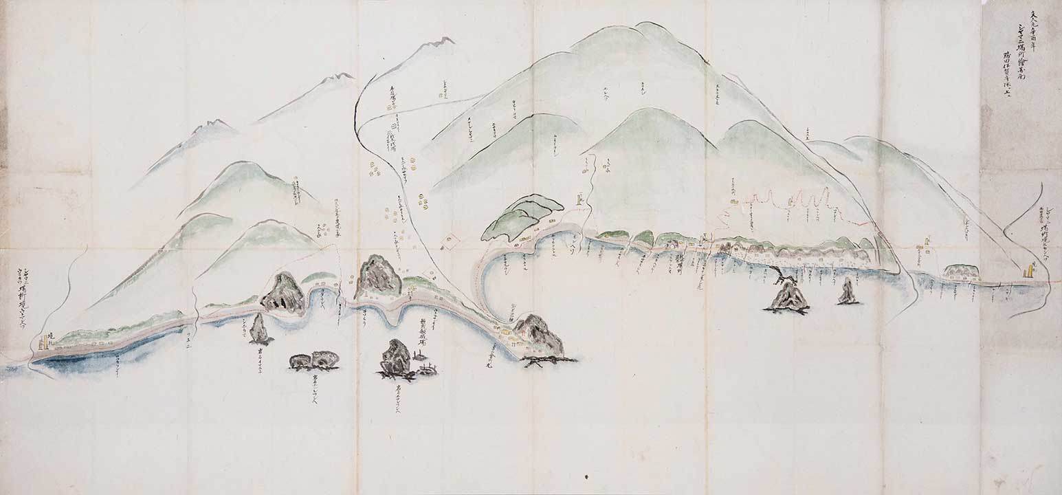
■Artist: Unknown
■Production year: 1861
■Actual size: 1185mm × 545mm
■作者:不明
■制作年:1861年
■実際のサイズ:1185mm × 545mm
This is a picture of Samani Kaisho (Shogunate Trade Office). It was painted in Bunkyu 1 (1861).
This picture was brought here in 1860 upon the relocation from Fukuyama (Matsumae Town) to Chikanai (Asahi, Samani Town) of the forefather of Sato Hachisaburo (Samani's first honorary townsman), who worked at the postal office in Horoman from Meiji 40 (1907). Although this picture was originally commissioned to be presented to Katsuta Iga-no-kami, the chief retainer of Fukuyama Castle, the opportunity to do so did not arise, so the picture remained in Samani as a valuable document.
Several dwellings, a temple, fishing grounds, mountains and rivers are depicted in vivid colors on a rectangular piece of Japanese washi paper. The landscape of Samani, unchanged in the present day, can be seen, including the topography of the coastline, Oyako-iwa and other shaped rocks, and Cape Enrumu. Inland settlements can be seen to have formed along the Samani River and the Monbetsu River, and their placenames and roles are described. The coastline is also detailed with placenames and river names, many of which are the same as in modern-day Samani. Try to see if you can find three sightseeing locations that are depicted in this painting: "Samani Kaisho", "Tojuin Temple", and "Fuyushima Hole Rock".
On the right side of the picture, Samani Sando (Mountain Path) is indicated with a dotted red line. Approximately 7km long, Samani Sando was carved from the mountain and opened as Ezo's first government-managed road in Kansei 11 (1799). In the modern day, its historical value is acknowledged through its designation as a national historical site. In this painting, the undulating shape of the mountain path is depicted, along with details such as Kotoni Rest Spot.
様似会所を描いた絵図です。文久元年(1861年)に作成されました。
明治40年(1907年)から幌満の駅逓所に職務をしていた佐藤八三郎(初代名誉町民)の先祖が1860年に福山(松前町)から誓内(様似町旭)に移住した際に遺した資料です。
元々は福山城の家老である勝田伊賀守に献上するために作成されましたが、その機会がなく手元に残された貴重な資料です。
長方形の和紙に人家、寺、漁場、山や川が色彩豊かに描かれています。海岸線の地形、親子岩などの奇岩やエンルム岬など現在と変わらない様似の風景が伺えます。内陸の集落は様似川や門別川沿いに形成されており、地名やその役割が記載されています。海岸線には地名や川名が記載され、現在の様似の地名と一致するものも多くあります。絵図に記載のある周遊サイト3か所「シャマニ会所」、「等澍院」、「冬島の穴岩」を探してみましょう。
右側には赤い破線で描かれた様似山道があります。様似山道は寛政11年(1799年)に約7kmの蝦夷地初の官営道路として開削されました。現在は歴史的価値が認められ、国の史跡として指定されました。絵図にはコトニ小休所なども記載され、山道の起伏も表現されています。
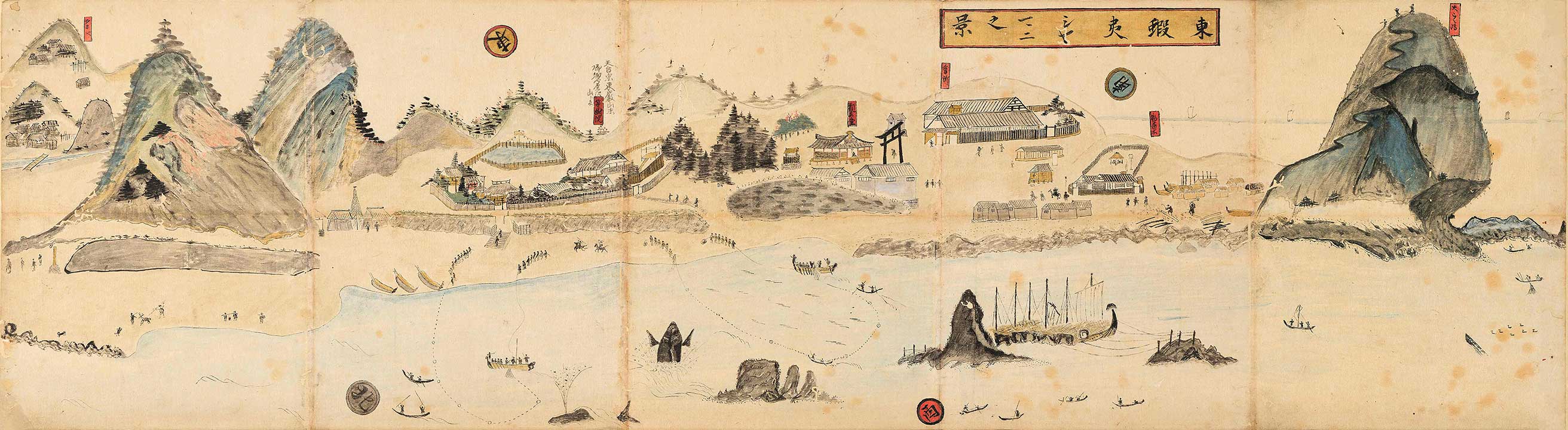
■Artist: Unknown
■Production year: Mid-19th century (late modern period)
■Actual size: 1350mm × 370mm
■作者:不明
■制作年:19世紀半ば(近世後期)
■実際のサイズ:1350mm × 370mm
This is a painting of the view from the Nishi-machi district to the Kaisho-machi district of Samani Town in the late 19th century (late modern period).
With depictions of buildings and people, we can gain a sense of the appearance of Samani at that time.
A replica of the painting, based on a high-resolution photograph of the original, is displayed at Samani Folk Museum. The original painting is stored in the collection of the National Ainu Museum in Shiraoi.
We can assume that this painting depicts Samani after Bunsei 4 (1821), since Tojuin Temple is shown in its latter location after being rebuilt. Furthermore, Samani Kaisho, one of the first ten Kaisho (Shogunate Trade Offices) to be established Eastern Ezo, is depicted. The Kaisho in this painting was extended several times until it ceased to be used, and even afterwards the building remained in use until it was destroyed by a typhoon in 1958.
To the left of Cape Enrumu, boats and two craftsmen wielding axes and adzes can be seen. This area was also used as a temporary shipyard where Benzai-sen (Benzai ships) were built, which transported goods that were traded at ports of call connecting Osaka and Hokkaido from the Edo period until the Meiji period. At the present-day location of Sobira-iwa, six moored Benzai-sen can be seen.
19世紀半ば(近世後期)の様似町の西町地区から会所町にかけてを描いた絵図です。
建物や人物など様似の当時の様子を知ることができます。
高精細写真をもとにした複製が様似郷土館で展示されており、本物は国立アイヌ民族博物館に所蔵されています。
移転をしたのちの等澍院が描かれており、文政4年(1821年)以降の様子が描かれたものと思われます。また、東蝦夷地に最初に作られた10会所のひとつである、シャマニ会所が描かれています。ここに描かれた会所の後、廃止までの間に何度か増築を繰り返し、その後も昭和30年代に台風で倒壊するまで現地で利用されていました。
エンルム岬の左には船と鉞(まさかり)や手斧をふるっている2人の職人が描かれています。かつてこの地には仮造船所もあり、江戸時代から明治時代にかけて活躍した、大阪と北海道とを結ぶ寄港地で商品を売り買いした弁財船も造られていたそうです。現在のソビラ岩のところに弁財船が6艘係留されています。
Shamani Ainu Spot List
シャマニ・アイヌ スポット一覧


- SAMANI Folk Museum 様似郷土館
- Former Site of the Kaisho (Shogunate Trade Office) 会所跡
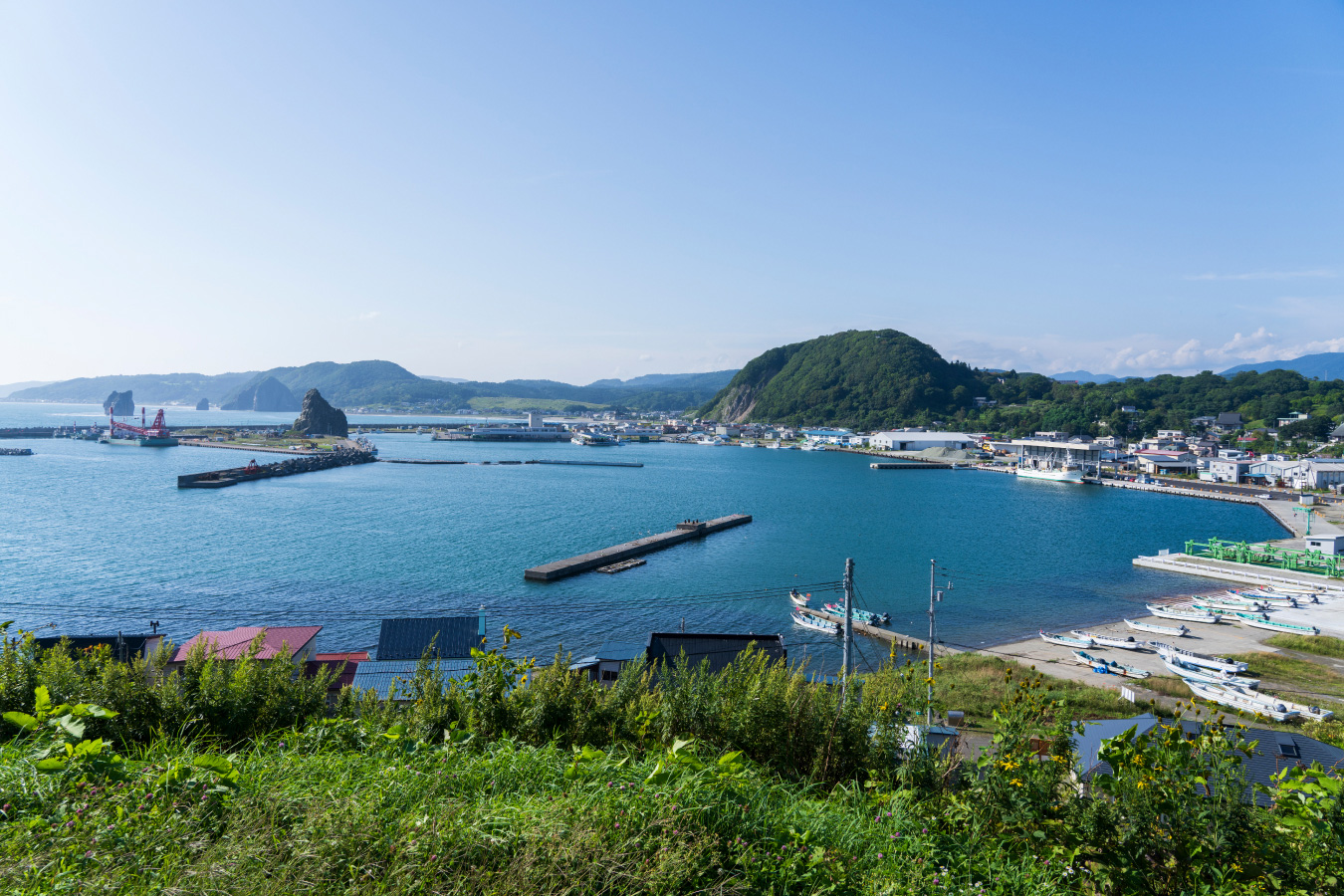
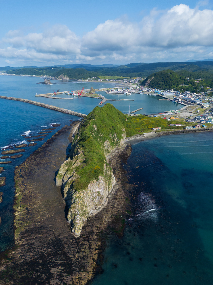
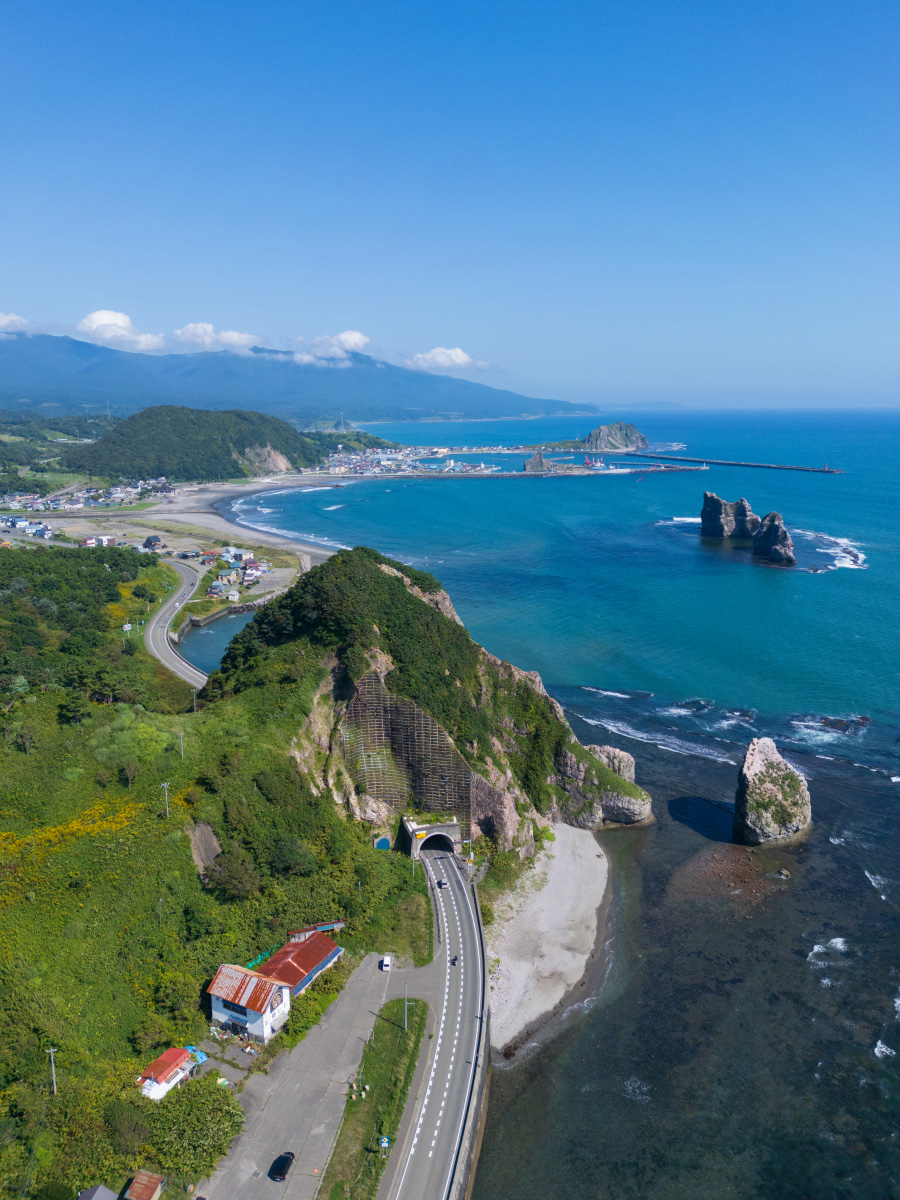
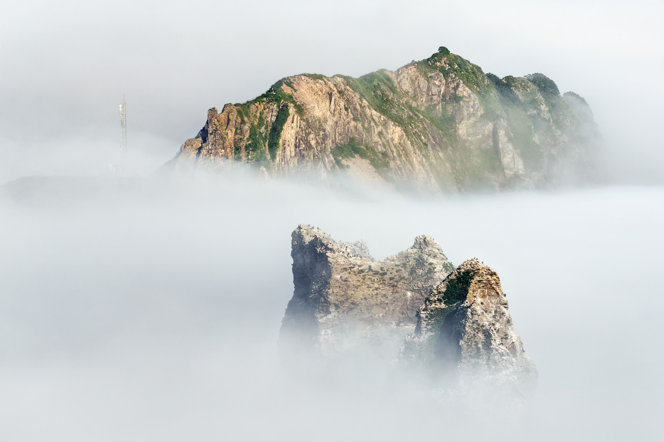
- Enrumu-misaki (Cape Enrumu) エンルム岬
- Sobira-iwa (Sobira Rock) ソビラ岩
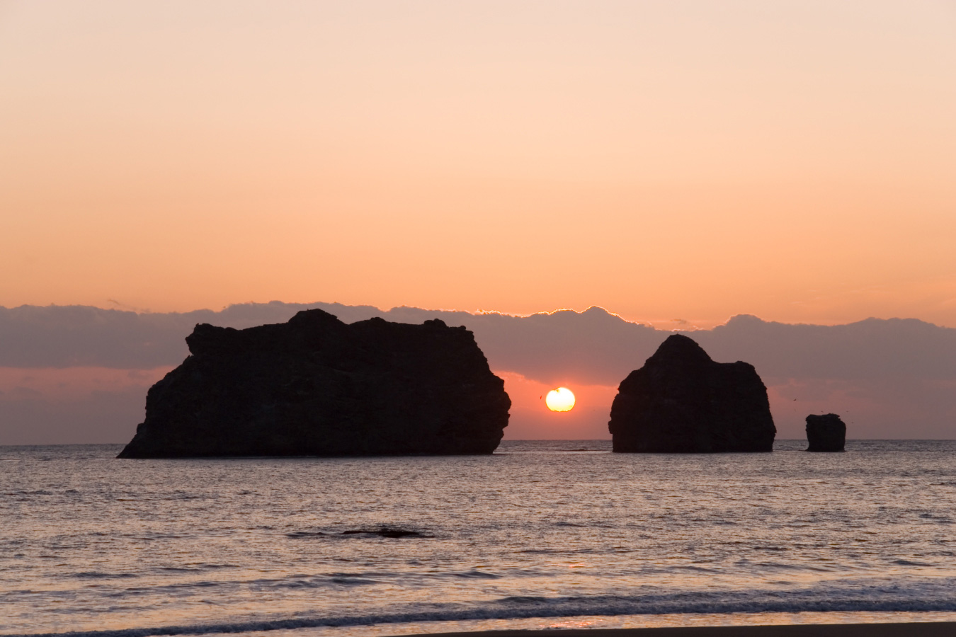
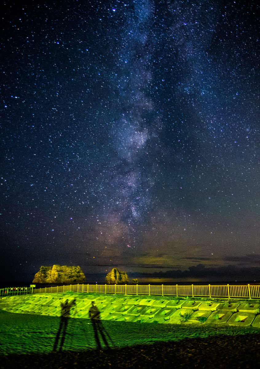
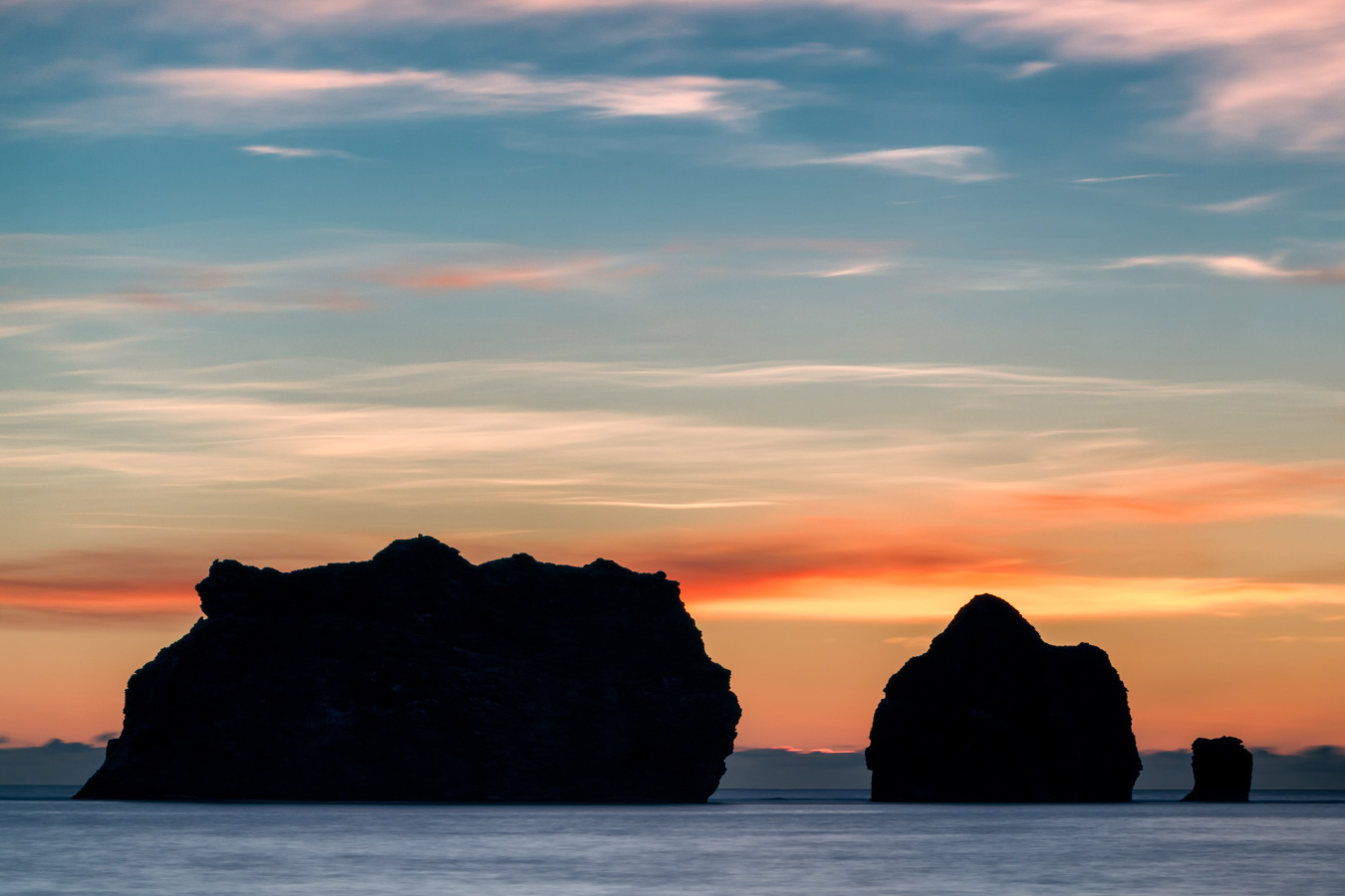
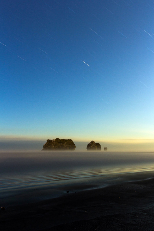
- Oyako-iwa (Parent and Child Rocks) 親子岩
- Hotahumpe, Nishi-machi 西町のホタフンペ
- Mt. Kannon Observatory 観音山展望台
- Ruins of Kamuycasi カムイチャシ跡
- Tojuin Temple 等澍院
- Samani Tourist Information Corner 様似観光案内所
- Cise of Okada 岡田のチセ
- Samani River 様似川
- Mt. Apoi Geopark Visitor Center アポイ岳ジオパークビジターセンター
- Mt. Apoi アポイ岳
- Fuyushima no ana-iwa (Hole Rock of Fuyushima) 冬島の穴岩
Shamani Ainu Stamp Rally
シャマニ・アイヌ スタンプラリー
Visitors can enjoy a stamp rally-style tour of 15 locations in Samani Town that are connected to Ainu culture.
How did the Samani Ainu people live, and what kind of legends have survived? When you travel to these locations, try to imagine Samani town as it was in the past, turning your thoughts to Ainu culture.
様似町内のアイヌ文化と関わりのある15の地点を、スタンプラリー形式で周遊できます。
様似のアイヌ民族はどのような暮らしをしていたのか、どんな伝説が残っているのか。現地へ赴いて、昔の様似町やアイヌ文化に思いをはせてみましょう。
Photo Gallery

Access
Scroll the map to the left and right.
地図は左右にスクロールします。
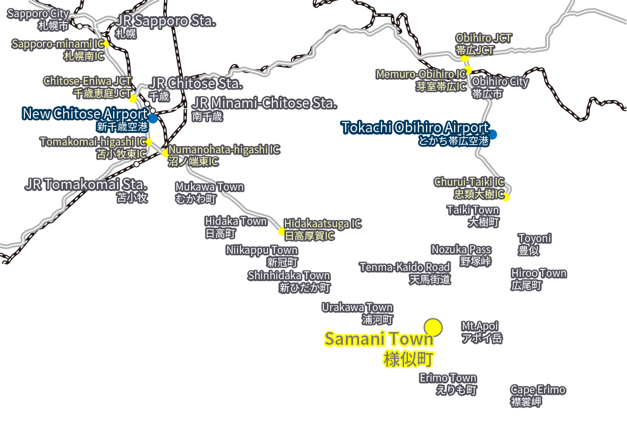
Visiting by Car自動車をご利用の方
From Sapporo to Samani Town
Approx. 185km/ Approx. 3 hrs 10 mins
札幌市から様似町/約185km・約3時間10分
From New Chitose Airport to Samani Town
Approx. 150km/ Approx. 2 hrs 30 mins
新千歳空港から様似町/約150km・約2時間30分
From Tomakomai to Samani Town
Approx. 150km/ Approx. 2 hrs 30 mins
苫小牧市から様似町/約150km・約2時間30分
From Tokachi-Obihiro Airport to Samani Town
Approx. 110km/ Approx. 1 hr 50 mins
とかち帯広空港から様似町/約110km・約1時間50分
From Obihiro to Samani Town
Approx. 140km/ Approx. 2 hrs 30 mins
帯広市から様似町/約140km・約2時間30分
Visiting by Public Transport Bus公共交通バスをご利用の方
-
Route Bus路線バス
-
JR Hokkaido Bus Regular Route Bus Bound for Samani (Nissho Line)
・From Shinhidaka Town to Samani Town: Approx. 2 hrs 20 mins
・From Urakawa Town to Samani Town: Approx. 30 mins
ジェイ・アール北海道バス 一般路線バス 様似方面(日勝線)
・新ひだか町から様似町 約2時間20分
・浦河町から様似町 約30分
Donan Bus (Tomakomai Shizunai Line)
・From Tomakomai to Shinhidaka Town: Approx. 2 hrs 40 mins
・From Shinhidaka Town to Urakawa Town: Approx. 1 hr 30 mins
道南バス(苫小牧静内線)
・苫小牧市から新ひだか町 約2時間40分
・新ひだか町から浦河町 約1時間30分
Tokachi Bus (Route Bus)
・From Obihiro to Hiroo Town: Approx. 2 hrs 30 mins
十勝バス(路線バス)
・帯広市から広尾町 約2時間30分
-
Intercity/Highway Bus都市間・高速バス
-
JR Hokkaido Bus
・From Sapporo to Samani Town: “Erimo Express” Bus” Bus, Approx. 3 hrs 30 mins
・From Tomakomai to Samani Town: “Tomamo Limited Express” Bus, Approx. 3 hrs 20 mins
* The Erimo Express and Tomamo Limited Express buses require advance reservation.
ジェイ・アール北海道バス
・札幌市から様似町「高速えりも号」約3時間30分
・苫小牧市から様似町「特急とまも号」約3時間20分
※えりも号、とまも号のご利用は事前予約が必要です。
Donan Bus
・From Sapporo to Urakawa Town: “Express Pegasus-go” Bus, Approx. 3 hrs 45 mins
* The Express Pegasus-go buses require advance reservation.
道南バス
・札幌市から浦河町「高速ペガサス号」約3時間45分
※ペガサス号のご利用は事前予約が必要です。